Abstract
The primary challenge in modernizing fire safety lies in the prevalence of analog legacy systems. Most high-occupancy buildings continue to utilize conventional fire alarm control panels that lack internet connectivity or intelligent zoning. Replacing these systems with native IoT sensors is often financially unfeasible and logistically disruptive.
This led to our proposal of a smart emergency evacuation system that retrofits legacy hardware using a microcontroller bridge to relay data to a GIS server. Due to regulatory constraints preventing live demonstration of our prototype, we validated this system using a hybrid model in Unity. By simulating evacuations in a Virtual Reality (VR) environment, we demonstrated that dynamic, informed navigation significantly outperforms traditional "nearest exit" instincts, even when accounting for human reaction delays.
Introduction
Fire emergencies in large, complex structures are characterized by panic and a lack of situational awareness. In legacy buildings, occupants typically react to a general siren by moving toward the most familiar exit, which may unintentionally lead them toward the fire's source.
Our approach addresses this by relaying information with existing analog systems. By tapping into the RS485 communication bus of conventional control panels, we can extract zone-specific data and transform it into actionable intelligence. This information is then distributed through a GIS server to public displays and personal mobile devices, providing a real-time "safest path" rather than just a "nearest path."
The Hardware Bridge Logic
To ensure zero interference with the critical operation of legacy Fire Alarm Control Panels (FACP), our ESP32-C6 microcontroller bridge operates exclusively in "Passive Sniffer Mode." It connects to the panel's existing RS485 peripheral bus without transmitting data back to the FACP (read-only mode).
The bridge utilizes a lookup table for proprietary protocols (such as those used by Ravel or Honeywell systems) to decode hexadecimal status bytes into Zone IDs. This isolated one-way communication ensures that our system functions purely as a secondary monitoring layer, legally classifying it as "supplementary" rather than "critical", simplifying regulatory compliance.
Hybrid Implementation
Due to legal and compliance restrictions on critical systems such as fire and safety equipment, a physical tapping of control panels of an operational building in our college was proving to be extremely difficult. However, we were allowed to access information about the system's operations and technical specifications which allowed us to adopt a hybrid implementation where we replicated the physical components into Unity and simulated the system's operation in an emergency scenario in VR in real time.
Ravel RE-700 Control Panel
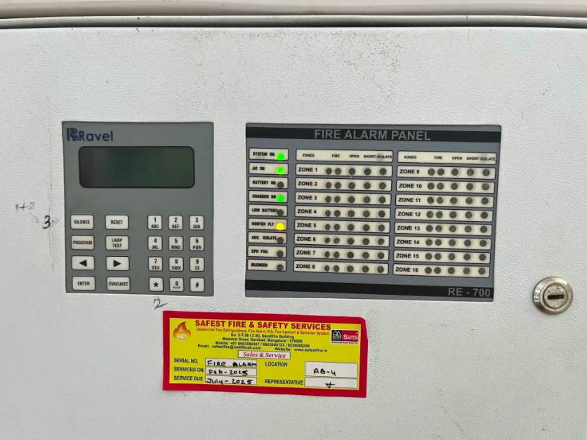
Ravel RE-700 Control Panel
Sensors inside each building are mapped into Zones representing a particular area of a particular floor. Status read from the sensors in each zone is all the information needed to dynamically create routes based on the user's position.
Ravel RE-104 Control Panel
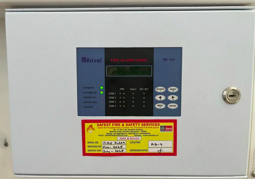
Ravel RE-104 Control Panel
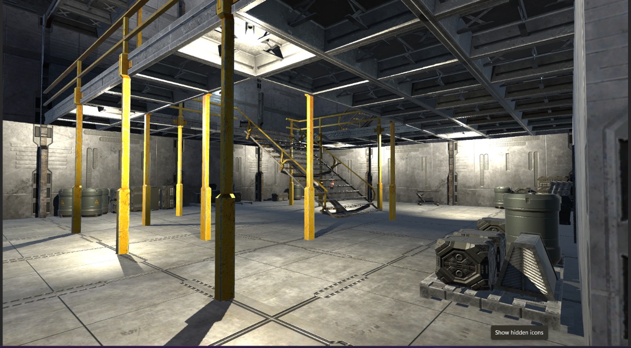
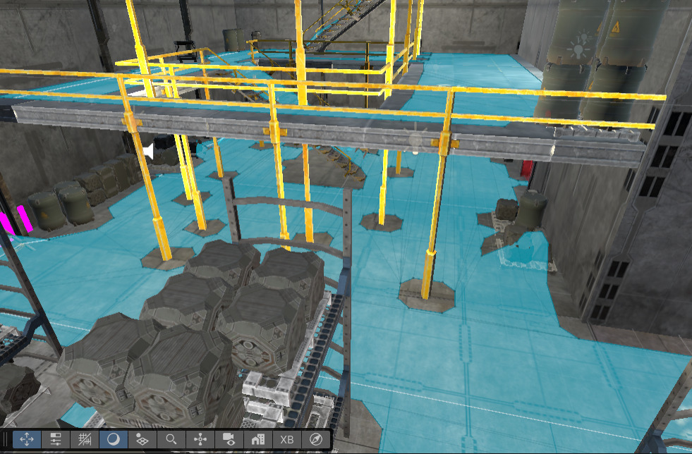
We replicated the architectural logic and sensor behavior of the building within the Unity engine. This digital replica functioned as a testing ground where virtual objects acting as "analog sensors" could be triggered to relay data to a simulated control panel. Initial prototyping was conducted in a virtual environment modeled after assets from publicly available assets to test pathfinding robustness, followed by a 1:1 scale model of our Academic Block 5 Building.
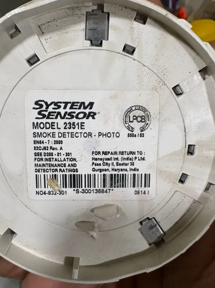
Smoke Detection Sensor

Initial Model with simulated fire
Initial Model with 3 floors and 4 exits
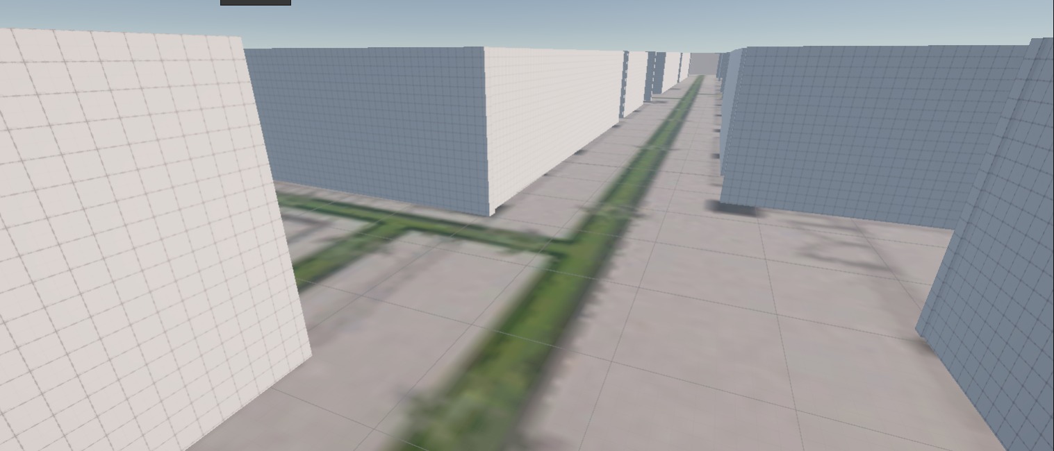
Testing NavMesh for Controlling Navigable Paths
To replicate the implementation of dynamic routing, we used NavMesh on each floor. NavMesh of an area (Zone) is removed if fire is detected in that Zone.
Testing NavMesh for controlling navigable paths
The A* (A-Star) Search Algorithm
The A* (A-Star) search algorithm optimizes for survivability. The map graph assigns a standard traversal weight to all edges (corridors). When the sensor detects smoke in a specific Zone, the server does not merely "block" that node - it applies a "Hazard Gradient" to adjacent nodes. Edges leading towards the fire receive an exponentially increasing weight penalty.
This ensures that if a user is trapped, the algorithm can still guide them through a "high-risk" path if it is the only option, but will prioritize "zero-risk" paths in all other scenarios. This calculation happens locally on the client device using the cached map, ensuring guidance continues even if server connection is lost mid-evacuation. (Once the map and logic are cached it can continue working without internet)
Dynamic Navigation System
Navigation system working dynamically based on location of the fire
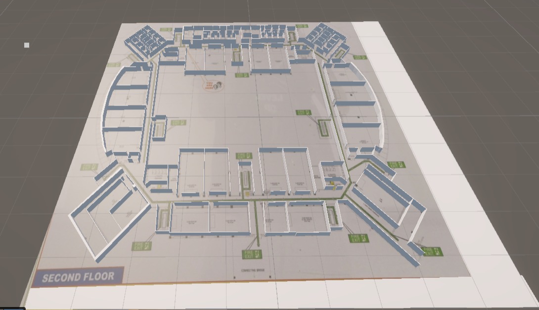
Replica of the academic building
Navigable paths in the academic building
Users were immersed in this environment using the Meta Quest 3 headset, allowing us to observe human behavior in a high-stress, simulated emergency without physical risk.
Evacuation Performance and Statistical Findings
Part of the testing phase involved a live demonstration of the prototype at a campus exhibition, we monitored two distinct groups: those following standard evacuation protocols and those using our smart navigation interface.
The data revealed a significant reduction in evacuation times. In the standard scenario, users often hesitated at junctions or took suboptimal routes, often running out of time or contacting the spreading fire.
In the smart navigation scenario, even after adding a mandatory 10-second buffer to represent the time taken for a human to perceive the alarm and check their device/nearby Display, the evacuation was nearly 40% faster for single floor, multiple exit model and 74% faster for multi floor, multiple exits model. These results confirmed that the clarity provided by visual, real-time guidance effectively reduces evacuation times and can be useful in scenarios with blocked exits.

Team at the Expo
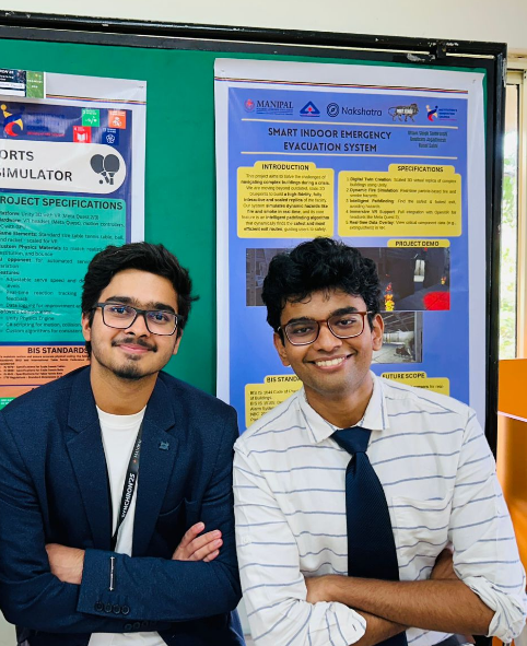
Team at the Expo
User Demonstration
User demonstration of the smart evacuation system
Current AR Implementation
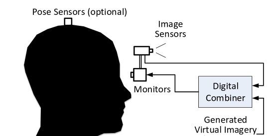
Our current outdoor AR navigation prototype utilizes Video See-Through (VST) Augmented Reality, combining GPS and Accelerometer, Magnetometer and Gyroscope data to overlay navigation cues onto the user's real-world view.
Source: www.augmentedrealitybook.org
AR navigation GIS demonstration
Future Work
Marker-Based Localisation
Pure GPS/IMU systems suffer from "drift" in indoor environments. To solve this, we are incorporating a marker-based localization approach. By placing high-contrast visual markers at critical decision points, such as stairwells and intersections, the system can recalibrate its coordinates instantly. This hybrid approach ensures that the navigation arrows remain pinned to the actual floor tiles regardless of sensor noise, providing a stable and trustworthy guide for the user.
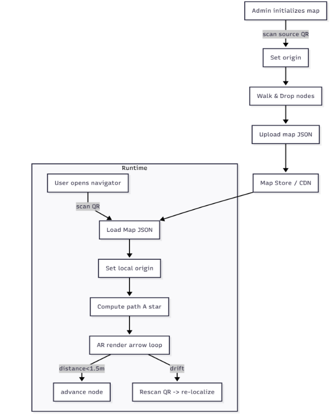
Process Flow Diagram
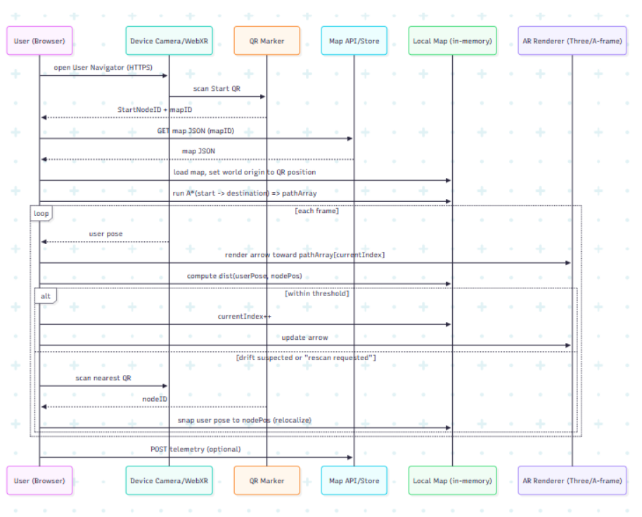
User Flow Algorithm
Lightweight Client Model
The reason for using passive scanning AR systems instead of an active scanning system utilizing SLAM is because the Interactive map must be usable via a mobile browser website, which comes with challenges of Battery usage, data, memory and high processing causing heat. Most prototypes either failed to run on the browser or crashed the browser after a few minutes of usage. To address the heavy computation required for SLAM (Simultaneous Localization and Mapping), our Plan of Action focuses on offloading static environment data. We propose a "Lightweight Client" model where the complex indoor map geometry is pre-cached on the user's device, while the server only sends small JSON packets containing the "active fire zones." This minimizes internet usage, which is often unreliable indoors.
Current SLAM prototype
Battery Optimization Strategy
As for the battery drain concern, as the camera and GPU must run simultaneously for AR. Our strategy involves a "Duty Cycle" for the camera sensor - instead of constant scanning, the camera scans only when the IMU detects the user has reached a navigational junction or when a marker is within the field of view. Furthermore, by utilizing marker-based localization instead of continuous cloud-based visual processing, we reduce the client-side CPU load. This ensures that the evacuation app remains functional even on mid-range smartphones with limited battery life, making the safety system accessible to a broader demographic within the building.
The Adoption Barrier: Regulatory Mindsets and Compliance
A significant hurdle for safety innovation in the Indian market is the prevailing mindset toward emergency infrastructure. In many sectors, fire safety systems are viewed as a "checklist" requirement—installed primarily to satisfy government mandates rather than as a proactive measure for human safety. Corporations and building owners are often hesitant to invest in supplementary technology unless it is strictly required by law.
To overcome this, our proposal emphasizes that this system is a high-value, low-cost "add-on" to existing infrastructure rather than a total replacement. By positioning the technology as a way to enhance the utility of already-mandated hardware, we aim to shift the perception of fire safety from a regulatory burden to a technologically advanced asset.
The Service Provider Strategy: Integration Through Outsourcing
In the current ecosystem, the procurement and maintenance of fire safety systems are almost exclusively outsourced to specialized third-party vendors. These service providers handle everything from sensor installation to the periodic testing of Fire Alarm Control Panels. Consequently, we could partner directly with these fitting providers if not the end-building owners.
By integrating our microcontroller bridge and GIS mapping services into the standard packages offered by these vendors, we can provide a cost-effective, "all-in-one" safety upgrade. This approach allows vendors to differentiate their services in a competitive market while ensuring that smart navigation becomes a standard feature of legacy building maintenance contracts.
Conclusion
Our smart emergency evacuation system demonstrates that legacy fire safety infrastructure can be enhanced with intelligent navigation without requiring expensive replacements. Through our hybrid Unity-VR validation, we've proven that dynamic, informed navigation significantly outperforms traditional evacuation instincts, reducing evacuation times by up to 74% in complex multi-floor scenarios.
By operating in passive sniffer mode and positioning our solution can act as a supplementary enhancement rather than a critical system replacement, addressing both technical and regulatory challenges. Our approach of partnering with existing fire safety service providers can create a viable pathway for adoption, transforming fire safety from a regulatory checkbox into a technologically advanced, life-saving asset.
As we continue to develop marker-based localization and optimize for mobile browser deployment, this system represents a scalable solution for retrofitting intelligent evacuation guidance into buildings across India and beyond.